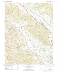
1993 Map of Geyserville
USGS Topo · Published 1993About this map
The Russian River defines the landscape of this portion of Sonoma County, winding through the fertile Alexander Valley where vineyards and agricultural operations dominate the valley floor. Geyserville serves as a central hub along the river, connected to outlying settlements like Chianti and Nervo by a network of levees and roads. To the west, the terrain rises sharply toward Bradford Mountain and the Big Ridge, where several small creeks such as Dutcher Creek and Peña Creek carve deep canyons before joining the larger Dry Creek system. The map captures a moment of established rural life, documenting local institutions like the Olive Hill Cemetery and Manzanita Sch. Near the southern boundary, the Healdsburg Municipal Airport and the Salvation Army Adult Rehabilitation Center mark the northern outskirts of the growing Healdsburg area, illustrating the mix of service industry and agriculture in the early 1990s.
Find a feature on this map
53 named features on this map. Tap any name to fly to it.
Don’t see what you’re looking for? This feature index may not catch every label — zoom into the map to look around manually.
Map Details
Editions of this 1993 Geyserville Map
This is the sole edition of this map. No revisions or reprints were ever made.
Other maps of this area

1920 · Healdsburg
USGS Topo · 1:62,500

1921 · Skaggs
USGS Topo · 1:62,500

1921 · Kelseyville
USGS Topo · 1:62,500

1933 · Healdsburg
USGS Topo · 1:48,000

1938 · Hopland
USGS Topo · 1:62,500

1940 · Healdsburg
USGS Topo · 1:62,500

1943 · Cazadero
USGS Topo · 1:24,000

1943 · Skaggs Springs
USGS Topo · 1:24,000

1943 · Kelseyville
USGS Topo · 1:62,500

1943 · Hopland
USGS Topo · 1:62,500