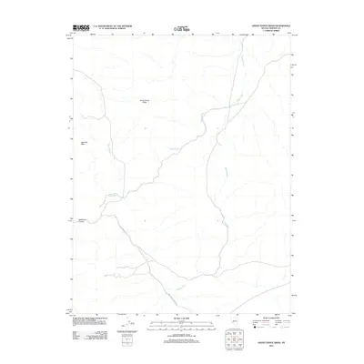
2011 Map of Ghost Dance Ridge
USGS Topo · Published 2011About this map
Ghost Dance Ridge serves as the central geological landmark in this part of Mineral County, Nevada. The high desert landscape is defined by the Agai Pah Hills and deep drainage systems that have shaped the local geography over millennia. Transport through this arid terrain relies on historic corridors like Gillis Canyon Rd and Wildhorse Canyon Rd, which navigate the elevation changes near Wildhorse Canyon. The drainage network, featuring Hidden Wash, Eagle Wash, and Wovoka Wash, illustrates the watershed patterns essential for understanding the region's historical hydrology. This survey provides a precise look at the road and drainage alignments as they existed in the early twenty-first century.
Find a feature on this map
8 named features on this map. Tap any name to fly to it.
Don’t see what you’re looking for? This feature index may not catch every label — zoom into the map to look around manually.
Map Details
Editions of this 2011 Ghost Dance Ridge Map
This is the sole edition of this map. No revisions or reprints were ever made.
Other maps of this area

1909 · Hawthorne
USGS Topo · 1:250,000

1911 · Hawthorne
USGS Topo · 1:250,000

1915 · Hawthorne
USGS Topo · 1:250,000

1948 · Walker Lake
USGS Topo · 1:250,000

1955 · Hawthorne
USGS Topo · 1:62,500

1957 · Walker Lake
USGS Topo · 1:250,000

1962 · Walker Lake
USGS Topo · 1:250,000

1964 · Walker Lake
USGS Topo · 1:250,000

1964 · Gillis Canyon
USGS Topo · 1:62,500
1979 · Copper Mtn.
USGS Topo · 1:24,000