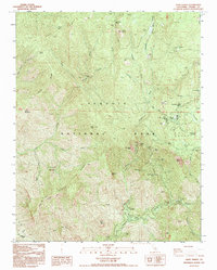
1993 Map of Giant Forest
USGS Topo · Published 1994About this map
The General Sherman Tree and the Giant Forest define this high-elevation landscape within Sequoia National Park during the early 1990s. The geography is dominated by deep canyons carved by the Marble Fork Kaweah River and Middle Fork Kaweah River, which drop steeply past landmarks like Marble Falls. This survey details the established park infrastructure of the era, from the winding Generals Highway to the residential pocket at Pinewood.
Find a feature on this map
63 named features on this map. Tap any name to fly to it.
Don’t see what you’re looking for? This feature index may not catch every label — zoom into the map to look around manually.
Map Details
Editions of this 1993 Giant Forest Map
This is the sole edition of this map. No revisions or reprints were ever made.
Other maps of this area

1903 · Tehipite
USGS Topo · 1:125,000

1904 · Kaweah
USGS Topo · 1:125,000

1905 · Tehipite
USGS Topo · 1:125,000

1909 · Kaweah
USGS Topo · 1:125,000

1937 · Kaweah
USGS Topo · 1:125,000

1948 · Fresno
USGS Topo · 1:250,000

1955 · Fresno
USGS Topo · 1:250,000

1956 · Fresno
USGS Topo · 1:250,000

1956 · Giant Forest
USGS Topo · 1:62,500

1956 · Mineral King
USGS Topo · 1:62,500