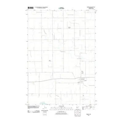
2010 Map of Gibbon
USGS Topo · Published 2010About this map
Gibbon serves as the central hub of this agricultural landscape in Sibley County, characterized by a sophisticated network of drainage and water management. The area is defined by its numerous ditches, such as County Ditch Number Thirtyone and County Ditch Number Nineteen, which facilitate farming across the prairie. Evidence of the region's geological history is found at the Alkali Lakebed, while the Middle Branch Rush River provides natural drainage towards the south. For genealogists and local historians, the sheet is particularly valuable for its concentration of four distinct burial sites: Saint Peter's Evangelical Cemetery, Saint Willibrord Cemetery, Augustana Cemetery, and the Gibbon Cemetery, reflecting the early spiritual and communal foundations of this Minnesota settlement.
Find a feature on this map
38 named features on this map. Tap any name to fly to it.
Don’t see what you’re looking for? This feature index may not catch every label — zoom into the map to look around manually.
Map Details
Editions of this 2010 Gibbon Map
This is the sole edition of this map. No revisions or reprints were ever made.
Other maps of this area

1953 · New Ulm
USGS Topo · 1:250,000

1957 · New Ulm
USGS Topo · 1:250,000

1958 · New Ulm
USGS Topo · 1:250,000

1958 · Winthrop
USGS Topo · 1:62,500

1964 · Fairfax
USGS Topo · 1:24,000

1964 · Sleepy Eye NW
USGS Topo · 1:24,000

1964 · Buffalo Lake
USGS Topo · 1:24,000

1964 · Lafayette
USGS Topo · 1:24,000

1964 · Hector
USGS Topo · 1:24,000

1964 · St George
USGS Topo · 1:24,000