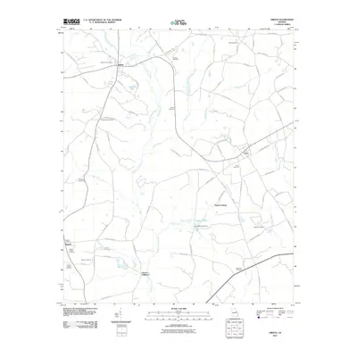
2011 Map of Gibson
USGS Topo · Published 2011About this map
Gibson serves as the focal point of this Glascock County landscape, where the confluence of Rocky Comfort Creek and Beechtree Creek shapes the local topography. The area's settlement history is deeply rooted in its rural cemeteries and small communities, from the town of Avera to the southern reach of Edgehill. Water resources have long dictated the movement and industry of the region, evidenced by landmarks like Glovers Millpond and Haddon Pond Dam.
Find a feature on this map
84 named features on this map. Tap any name to fly to it.
Don’t see what you’re looking for? This feature index may not catch every label — zoom into the map to look around manually.
Map Details
Editions of this 2011 Gibson Map
This is the sole edition of this map. No revisions or reprints were ever made.
Other maps of this area

1920 · Stapleton
USGS Topo · 1:62,500

1922 · Harlem
USGS Topo · 1:62,500

1948 · Harlem
USGS Topo · 1:62,500

1948 · Stapleton
USGS Topo · 1:62,500

1948 · Louisville
USGS Topo · 1:24,000

1950 · Louisville
USGS Topo · 1:24,000

1950 · Wrens
USGS Topo · 1:24,000
1950 · Bowdens Pond
USGS Topo · 1:24,000

1953 · Athens
USGS Topo · 1:250,000

1958 · Athens
USGS Topo · 1:250,000