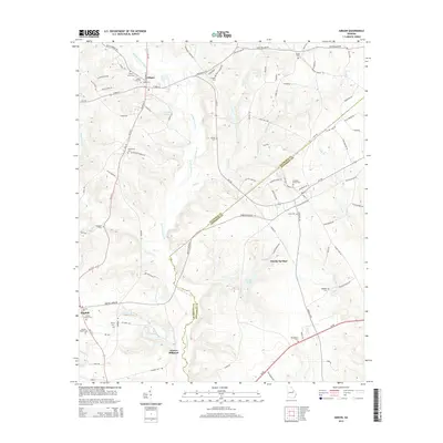
2014 Map of Gibson
USGS Topo · Published 2014About this map
Gibson serves as the focal point of this Glascock County landscape, where the town's grid meets a network of rural routes like Bastonville Rd and Ga-102. The terrain is defined by the winding course of Rocky Comfort Cr, which feeds into Glovers Millpond and is joined by numerous tributaries including Beechtree Cr and Joes Cr. This area maintains a strong connection to its 19th and 20th-century roots, evidenced by the high density of family and community burial grounds such as Waldens Cem and McCoy Cem.
Find a feature on this map
106 named features on this map. Tap any name to fly to it.
Don’t see what you’re looking for? This feature index may not catch every label — zoom into the map to look around manually.
Map Details
Editions of this 2014 Gibson Map
This is the sole edition of this map. No revisions or reprints were ever made.
Other maps of this area

1920 · Stapleton
USGS Topo · 1:62,500

1922 · Harlem
USGS Topo · 1:62,500

1948 · Harlem
USGS Topo · 1:62,500

1948 · Stapleton
USGS Topo · 1:62,500

1948 · Louisville
USGS Topo · 1:24,000

1950 · Louisville
USGS Topo · 1:24,000

1950 · Wrens
USGS Topo · 1:24,000
1950 · Bowdens Pond
USGS Topo · 1:24,000

1953 · Athens
USGS Topo · 1:250,000

1958 · Athens
USGS Topo · 1:250,000