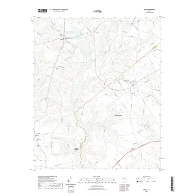
2020 Map of Gibson
USGS Topo · Published 2020About this map
Gibson serves as the seat of Glascock County, anchored by the Glascock County Courthouse and a surrounding network of residential streets like Railroad Ave and Calhoun St. The town's layout reflects a transition from early rail-dependent commerce to a modern rural center. To the southeast, the small town of Avera is similarly organized around its central thoroughfares, while the landscape beyond these hubs is defined by traditional community pillars. Numerous rural congregations and burial grounds, such as Waldens Church Cem and Jordans Chapel Cem, are scattered throughout the countryside.
Find a feature on this map
110 named features on this map. Tap any name to fly to it.
Don’t see what you’re looking for? This feature index may not catch every label — zoom into the map to look around manually.
Map Details
Editions of this 2020 Gibson Map
This is the sole edition of this map. No revisions or reprints were ever made.
Other maps of this area

1920 · Stapleton
USGS Topo · 1:62,500

1922 · Harlem
USGS Topo · 1:62,500

1948 · Harlem
USGS Topo · 1:62,500

1948 · Stapleton
USGS Topo · 1:62,500

1948 · Louisville
USGS Topo · 1:24,000

1950 · Louisville
USGS Topo · 1:24,000

1950 · Wrens
USGS Topo · 1:24,000
1950 · Bowdens Pond
USGS Topo · 1:24,000

1953 · Athens
USGS Topo · 1:250,000

1958 · Athens
USGS Topo · 1:250,000