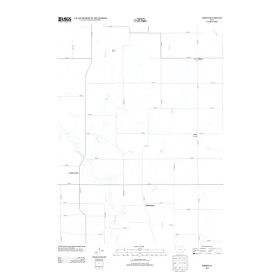
2013 Map of Gibson
USGS Topo · Published 2013About this map
The N Skunk River meanders through the southern half of this Keokuk County landscape, defining the rural character of a region historically tied to agriculture and small-town junctions. Small community clusters such as Indianapolis and Spring Valley are situated along the river's drainage, while Gibson stands in the northeast corner near the S English River. The grid of section roads, including Urbana Ave and Yale Ave, reveals a tightly organized township structure typical of the Iowa prairie.
Find a feature on this map
36 named features on this map. Tap any name to fly to it.
Don’t see what you’re looking for? This feature index may not catch every label — zoom into the map to look around manually.
Map Details
Editions of this 2013 Gibson Map
This is the sole edition of this map. No revisions or reprints were ever made.
Other maps of this area

1954 · Des Moines
USGS Topo · 1:250,000

1956 · Des Moines
USGS Topo · 1:250,000

1957 · Des Moines
USGS Topo · 1:250,000

1965 · Gibson
USGS Topo · 1:24,000

1965 · Rose Hill
USGS Topo · 1:24,000

1965 · What Cheer
USGS Topo · 1:24,000

1965 · Delta
USGS Topo · 1:24,000

1968 · Deep River
USGS Topo · 1:24,000

1968 · University Park
USGS Topo · 1:24,000

1968 · Barnes City
USGS Topo · 1:24,000