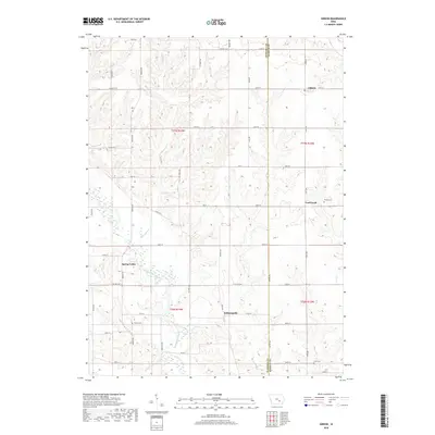
2018 Map of Gibson
USGS Topo · Published 2018About this map
The North Skunk River meanders across the southern portion of this landscape on the border of Mahaska and Keokuk counties, anchoring a network of agricultural land and small settlements. The community of Indianapolis sits just north of the river, while the town of Gibson occupies the northeastern corner of the quadrangle. This area of Iowa is defined by its rural grid of roads, such as Co Hwy G13 and Co Hwy G29, which connect dispersed homesteads and local landmarks. For genealogists and local historians, several small burial grounds provide specific points of interest, including Friends Cem near Coal Creek and the Tinsley Cem further west. Smaller watercourses like Pleasant Cr and Cedar Cr drain the undulating terrain, shaping the placement of early townships like Spring Valley.
Find a feature on this map
47 named features on this map. Tap any name to fly to it.
Don’t see what you’re looking for? This feature index may not catch every label — zoom into the map to look around manually.
Map Details
Editions of this 2018 Gibson Map
This is the sole edition of this map. No revisions or reprints were ever made.
Other maps of this area

1954 · Des Moines
USGS Topo · 1:250,000

1956 · Des Moines
USGS Topo · 1:250,000

1957 · Des Moines
USGS Topo · 1:250,000

1965 · Gibson
USGS Topo · 1:24,000

1965 · Rose Hill
USGS Topo · 1:24,000

1965 · What Cheer
USGS Topo · 1:24,000

1965 · Delta
USGS Topo · 1:24,000

1968 · Deep River
USGS Topo · 1:24,000

1968 · University Park
USGS Topo · 1:24,000

1968 · Barnes City
USGS Topo · 1:24,000