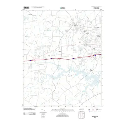
2010 Map of Gibsonville
USGS Topo · Published 2010About this map
Gibsonville and the neighboring community of Elon anchor this 2010 survey of the Piedmont landscape. The map highlights a period of suburban expansion into former agricultural lands, evidenced by a dense network of residential developments such as Westbrook Forest, Country Club Acres, and Glenwood Acres. The landscape is defined by the winding paths of Big Alamance Creek and Little Alamance Creek, which feed into local impoundments like Gerrards Lake. Small-scale aviation is a notable feature of the area, with both McLean Brothers Airport and Clayton Airpark serving the region between the established towns and the village of Whitsett. Local history is reflected in several longstanding rural roads, including Shallowford Church Rd and Saint John Church Rd, while Alamence Memorial Park serves as a significant central landmark for the surrounding communities.
Find a feature on this map
86 named features on this map. Tap any name to fly to it.
Don’t see what you’re looking for? This feature index may not catch every label — zoom into the map to look around manually.
Map Details
Editions of this 2010 Gibsonville Map
This is the sole edition of this map. No revisions or reprints were ever made.
Other maps of this area

1951 · Browns Summit
USGS Topo · 1:24,000

1952 · Mc Leansville
USGS Topo · 1:24,000

1953 · Raleigh
USGS Topo · 1:250,000

1953 · Greensboro
USGS Topo · 1:250,000

1954 · Greensboro
USGS Topo · 1:250,000

1954 · Raleigh
USGS Topo · 1:250,000

1962 · Greensboro
USGS Topo · 1:250,000

1966 · Greensboro
USGS Topo · 1:250,000

1969 · Burlington
USGS Topo · 1:24,000

1969 · Lake Burlington
USGS Topo · 1:24,000