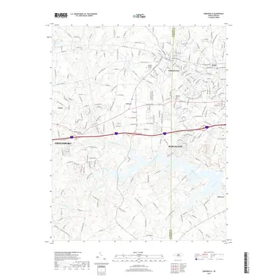
2019 Map of Gibsonville
USGS Topo · Published 2019About this map
Gibsonville and Elon anchor the northern reaches of this map, straddling the county line where the Piedmont landscape transitions between Guilford and Alamance counties. This 2019 survey documents a region defined by established suburban growth and historical rural corridors. The drainage systems of Big Alamance Creek and Little Alamance Creek carve through the southern half of the quadrangle, influencing the local topography and road network.
Find a feature on this map
218 named features on this map. Tap any name to fly to it.
Don’t see what you’re looking for? This feature index may not catch every label — zoom into the map to look around manually.
Map Details
Editions of this 2019 Gibsonville Map
This is the sole edition of this map. No revisions or reprints were ever made.
Other maps of this area

1951 · Browns Summit
USGS Topo · 1:24,000

1952 · Mc Leansville
USGS Topo · 1:24,000

1953 · Raleigh
USGS Topo · 1:250,000

1953 · Greensboro
USGS Topo · 1:250,000

1954 · Greensboro
USGS Topo · 1:250,000

1954 · Raleigh
USGS Topo · 1:250,000

1962 · Greensboro
USGS Topo · 1:250,000

1966 · Greensboro
USGS Topo · 1:250,000

1969 · Burlington
USGS Topo · 1:24,000

1969 · Lake Burlington
USGS Topo · 1:24,000