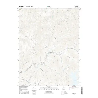
2016 Map of Gilboa
USGS Topo · Published 2016About this map
Gilboa and Enon occupy the high ground of the Turnpike Road corridor in this southern portion of Nicholas County. The landscape is defined by the sharp descent from these ridge-top settlements into a dense network of drainages, including Peters Creek and the Rockcamp Branch. To the south, the terrain meets the northern reaches of Summersville Lake, where Summersville Lake Road connects the small communities of Tipton and Poe. Genealogists will find several family and community burial grounds preserved in the topography, such as Duling Cemetery near Gilboa and the Keenan Cemetery situated above Peters Creek. The map also documents essential infrastructure like the Water Supply Reservoir near Burl, illustrating the modern management of the area's abundant water resources.
Find a feature on this map
69 named features on this map. Tap any name to fly to it.
Don’t see what you’re looking for? This feature index may not catch every label — zoom into the map to look around manually.
Map Details
Editions of this 2016 Gilboa Map
This is the sole edition of this map. No revisions or reprints were ever made.
Other maps of this area

1889 · Nicholas
USGS Topo · 1:125,000

1891 · Nicholas
USGS Topo · 1:125,000

1897 · Kanawha Falls
USGS Topo · 1:125,000

1900 · Kanawha Falls
USGS Topo · 1:125,000

1901 · Nicholas
USGS Topo · 1:125,000

1901 · Kanawha Falls
USGS Topo · 1:125,000

1908 · Clay
USGS Topo · 1:48,000

1908 · Fayetteville
USGS Topo · 1:48,000

1910 · Clay
USGS Topo · 1:62,500

1910 · Fayetteville
USGS Topo · 1:62,500