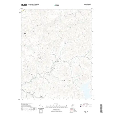
2019 Map of Gilboa
USGS Topo · Published 2019About this map
Gilboa and the surrounding Nicholas County highlands are defined by a network of steep-cut drainages that flow toward the northern reaches of Summersville Lake. This terrain has historically dictated a settlement pattern of small, dispersed communities like Zela, Enon, and Burl, often situated along ridgelines or where major hollows meet. For genealogists, the map identifies several family-named landmarks and resting places, including Duling Cem, Keenan Cem, and McClutchin Cem. The transportation network is anchored by Turnpike Rd, which connects these hamlets across the rugged plateau. Further south, the map captures the transition to the lake's edge near Poe and Tipton, where the Water Supply Reservoir and seasonal inflows like Sugarcamp Run shape the local landscape. The presence of Mine Rd in the western section hints at the industrial underpinnings of the local economy in this part of West Virginia.
Find a feature on this map
70 named features on this map. Tap any name to fly to it.
Don’t see what you’re looking for? This feature index may not catch every label — zoom into the map to look around manually.
Map Details
Editions of this 2019 Gilboa Map
This is the sole edition of this map. No revisions or reprints were ever made.
Other maps of this area

1889 · Nicholas
USGS Topo · 1:125,000

1891 · Nicholas
USGS Topo · 1:125,000

1897 · Kanawha Falls
USGS Topo · 1:125,000

1900 · Kanawha Falls
USGS Topo · 1:125,000

1901 · Nicholas
USGS Topo · 1:125,000

1901 · Kanawha Falls
USGS Topo · 1:125,000

1908 · Clay
USGS Topo · 1:48,000

1908 · Fayetteville
USGS Topo · 1:48,000

1910 · Clay
USGS Topo · 1:62,500

1910 · Fayetteville
USGS Topo · 1:62,500