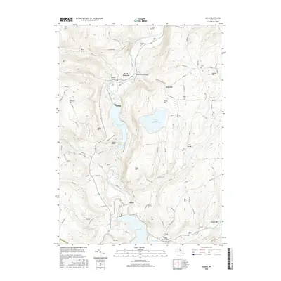
2016 Map of Gilboa
USGS Topo · Published 2016About this map
Schoharie Creek dominates this region of the northern Catskills, serving as the central artery for a landscape defined by significant water management and rural hamlets. The valley floor is marked by the Blenheim Gilboa Reservoir and the northern reaches of the Schoharie Reservoir, illustrating the area's role in regional utility and recreation through Mine Kill State Park. Historic infrastructure is represented by the Blenheim Covered Bridge near North Blenheim, while the surrounding slopes of Blenheim Mtn and Stevens Mtn are carved by dramatic water features like Mine Kill Falls and Manorkill Falls. Genealogists will find a high density of family burial grounds, including the Knisker Cem, Clapper Cem, and Richtmyer Case Cem, which are scattered among the ridges and small settlements like Owlsville and West Conesville.
Find a feature on this map
115 named features on this map. Tap any name to fly to it.
Don’t see what you’re looking for? This feature index may not catch every label — zoom into the map to look around manually.
Map Details
Editions of this 2016 Gilboa Map
This is the sole edition of this map. No revisions or reprints were ever made.
Other maps of this area

1898 · Schoharie
USGS Topo · 1:62,500

1900 · Schoharie
USGS Topo · 1:62,500

1901 · Gilboa
USGS Topo · 1:62,500

1903 · Gilboa
USGS Topo · 1:62,500

1904 · Richmondville
USGS Topo · 1:62,500

1904 · Hobart
USGS Topo · 1:62,500

1943 · Breakabeen
USGS Topo · 1:24,000

1943 · Summit
USGS Topo · 1:24,000
1944 · Middleburgh
USGS Topo · 1:24,000
1945 · Summit
USGS Topo · 1:31,680