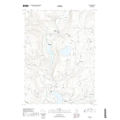
2019 Map of Gilboa
USGS Topo · Published 2019About this map
Schoharie Creek dominates the landscape of this northern Catskills region, where significant hydroelectric and water management infrastructure has reshaped the valley. The massive Blenheim Gilboa Reservoir and Schoharie Reservoir are central features, indicating the area's vital role in regional utility networks. Nearby, Mine Kill State Park preserves the area around Mine Kill Falls, while the historic Blenheim Covered Bridge stands near North Blenheim as a landmark of earlier local engineering.
Find a feature on this map
118 named features on this map. Tap any name to fly to it.
Don’t see what you’re looking for? This feature index may not catch every label — zoom into the map to look around manually.
Map Details
Editions of this 2019 Gilboa Map
This is the sole edition of this map. No revisions or reprints were ever made.
Other maps of this area

1898 · Schoharie
USGS Topo · 1:62,500

1900 · Schoharie
USGS Topo · 1:62,500

1901 · Gilboa
USGS Topo · 1:62,500

1903 · Gilboa
USGS Topo · 1:62,500

1904 · Richmondville
USGS Topo · 1:62,500

1904 · Hobart
USGS Topo · 1:62,500

1943 · Breakabeen
USGS Topo · 1:24,000

1943 · Summit
USGS Topo · 1:24,000
1944 · Middleburgh
USGS Topo · 1:24,000
1945 · Summit
USGS Topo · 1:31,680