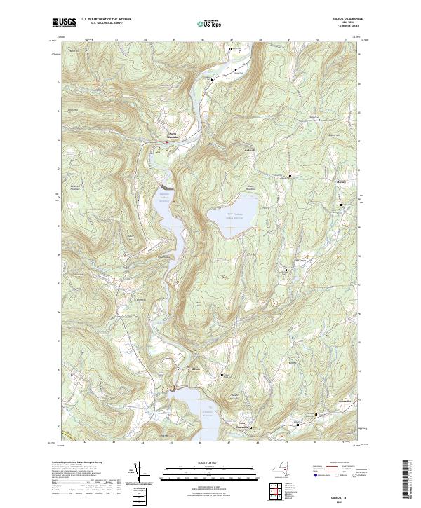
2023 Map of Gilboa
USGS Topo · Published 2023About this map
Schoharie Creek carves a deep valley through this northern Catskills landscape, defined by the significant hydraulic engineering of the Blenheim Gilboa Reservoir and the Upper Blenheim Gilboa Reservoir. The settlement of Gilboa sits at the northern edge of the Schoharie Reservoir, a central hub for the surrounding rural hamlets of Mackey, Owlsville, and Flat Creek. Genealogy researchers will find a high density of small family and community burial grounds, including the Safford Cem, Patrie Cem, and Richtmyer Case Cem, many tucked away on hillsides like Safford Hill or near the banks of the Manor Kill. The presence of the Mine Kill State Park and landmarks like Mine Kill Falls highlight the area's transition from a strictly agricultural and milling economy toward one focused on water resource management and recreation.
Find a feature on this map
118 named features on this map. Tap any name to fly to it.
Don’t see what you’re looking for? This feature index may not catch every label — zoom into the map to look around manually.
Map Details
Editions of this 2023 Gilboa Map
This is the sole edition of this map. No revisions or reprints were ever made.
Other maps of this area

1898 · Schoharie
USGS Topo · 1:62,500

1900 · Schoharie
USGS Topo · 1:62,500

1901 · Gilboa
USGS Topo · 1:62,500

1903 · Gilboa
USGS Topo · 1:62,500

1904 · Richmondville
USGS Topo · 1:62,500

1904 · Hobart
USGS Topo · 1:62,500

1943 · Breakabeen
USGS Topo · 1:24,000

1943 · Summit
USGS Topo · 1:24,000
1944 · Middleburgh
USGS Topo · 1:24,000
1945 · Summit
USGS Topo · 1:31,680