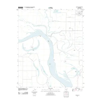
2011 Map of Gillett
USGS Topo · Published 2011About this map
The town of Gillett sits in the northeast corner of this survey, overlooking a complex riverine landscape dominated by the winding path of the Arkansas River. This section of the river is defined by deep meanders and oxbow formations such as Taylor Old River and Moody Old River, which illustrate the shifting nature of the Delta's waterways over time. Significant water bodies like Bayou Meto, Moore Bayou, and Bills Bayou crisscross the lowlands, creating a network of drainage and transport routes that shaped early settlement.
Find a feature on this map
40 named features on this map. Tap any name to fly to it.
Don’t see what you’re looking for? This feature index may not catch every label — zoom into the map to look around manually.
Map Details
Editions of this 2011 Gillett Map
This is the sole edition of this map. No revisions or reprints were ever made.
Other maps of this area

1935 · Varner
USGS Topo · 1:62,500

1935 · Rotan
USGS Topo · 1:62,500

1935 · Red Fork
USGS Topo · 1:62,500

1935 · Gillett
USGS Topo · 1:62,500

1948 · Helena
USGS Topo · 1:250,000

1950 · Helena
USGS Topo · 1:250,000

1953 · Greenwood
USGS Topo · 1:250,000

1955 · Helena
USGS Topo · 1:250,000

1956 · Greenwood
USGS Topo · 1:250,000

1959 · Helena
USGS Topo · 1:250,000