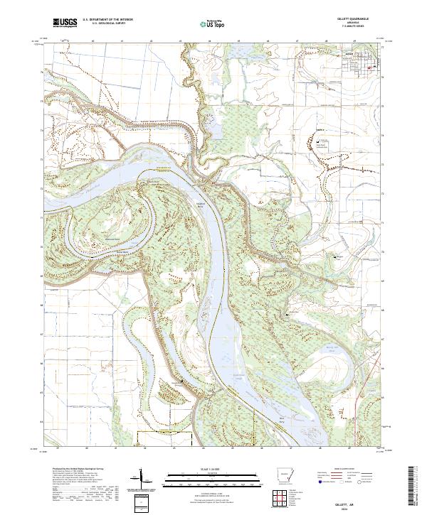
2024 Map of Gillett
USGS Topo · Published 2024About this map
Gillett sits at the northern edge of this Delta landscape, where the shifting hydrology of the Arkansas River defines the terrain. The river's serpentine path is marked by dramatic oxbows and landforms like Thedford Bend, Bicker Bend, and Taylor Old River, illustrating the historical movement of the channel across the floodplain. Large portions of the eastern and southern sections are dedicated to the Dale Bumpers White River National Wildlife Refuge, a dense network of wetlands, bayous, and lakes including Moore Bayou and Moody Old River.
Find a feature on this map
60 named features on this map. Tap any name to fly to it.
Don’t see what you’re looking for? This feature index may not catch every label — zoom into the map to look around manually.
Map Details
Editions of this 2024 Gillett Map
This is the sole edition of this map. No revisions or reprints were ever made.
Other maps of this area

1935 · Varner
USGS Topo · 1:62,500

1935 · Rotan
USGS Topo · 1:62,500

1935 · Red Fork
USGS Topo · 1:62,500

1935 · Gillett
USGS Topo · 1:62,500

1948 · Helena
USGS Topo · 1:250,000

1950 · Helena
USGS Topo · 1:250,000

1953 · Greenwood
USGS Topo · 1:250,000

1955 · Helena
USGS Topo · 1:250,000

1956 · Greenwood
USGS Topo · 1:250,000

1959 · Helena
USGS Topo · 1:250,000