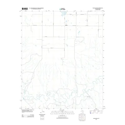
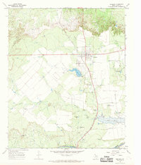
2013 Map of Gilliland
USGS Topo · Published 2013About this map
Gilliland serves as the central point of this West Texas landscape, where the flat upland plains meet the increasingly broken terrain of the river breaks. The map documents a predominantly ranching economy, characterized by large landholdings like the Burnett Ranch positioned along the southern reaches of the sheet. The drainage patterns are defined by the winding course of the S Wichita River, which creates a complex series of bends and alluvial flats as it moves through the southern territory. This waterway is joined by tributaries such as Ilseng Cr, which cuts northward through the center of the quadrangle. Transport in the region is defined by a grid of county roads and key regional arteries including Ranch Road 1756 and Ranch Road 267, providing essential connections between isolated ranchsteads and local shipping points.
Find a feature on this map
16 named features on this map. Tap any name to fly to it.
Don’t see what you’re looking for? This feature index may not catch every label — zoom into the map to look around manually.
Map Details
Editions of this 2013 Gilliland Map
This is the sole edition of this map. No revisions or reprints were ever made.
Other maps of this area

1954 · Wichita Falls
USGS Topo · 1:250,000

1958 · Wichita Falls
USGS Topo · 1:250,000
1966 · Truscott North
USGS Topo · 1:24,000
1966 · Colwell Creek
USGS Topo · 1:24,000
1966 · Truscott South
USGS Topo · 1:24,000
1966 · Halsell Ranch
USGS Topo · 1:24,000
1966 · Gilliland
USGS Topo · 1:24,000
1966 · Vera
USGS Topo · 1:24,000
1967 · Hefner
USGS Topo · 1:24,000
1967 · Benjamin
USGS Topo · 1:24,000