
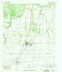
1967 Map of Benjamin
USGS Topo · Published 1969About this map
The town of Benjamin serves as the focal point of this late 1960s survey, situated where the Atchison Topeka and Santa Fe railroad corridor cuts through the North Texas landscape. The region's cattle-ranching heritage is evident through named properties like the Hamilton Ranch and League Ranch, alongside several local water tanks designed for livestock, such as South Jones Tank and Quintana Tank.
Find a feature on this map
29 named features on this map. Tap any name to fly to it.
Don’t see what you’re looking for? This feature index may not catch every label — zoom into the map to look around manually.
Map Details
Editions of this 1967 Benjamin Map
This is the sole edition of this map. No revisions or reprints were ever made.
Other maps of this area

1954 · Wichita Falls
USGS Topo · 1:250,000

1958 · Wichita Falls
USGS Topo · 1:250,000

1966 · Truscott South
USGS Topo · 1:24,000

1966 · Gilliland
USGS Topo · 1:24,000

1966 · Maverick Flat
USGS Topo · 1:24,000

1967 · Cedar Mountain
USGS Topo · 1:24,000

1967 · Knox City NW
USGS Topo · 1:24,000

1967 · Rhineland
USGS Topo · 1:24,000

1968 · Munday West
USGS Topo · 1:24,000
1968 · Knox City
USGS Topo · 1:24,000