
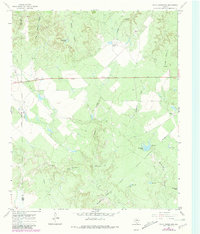
1967 Map of Cedar Mountain
USGS Topo · Published 1969About this map
Cedar Mountain dominates the eastern horizon of this 1967 survey, where the rolling ranchlands of West Texas are deeply cut by a network of drainage canyons. The map documents a landscape defined by the livestock industry and water management, featuring several family-named ranch headquarters including Driver Ranch, Lyles Ranch, and McFaddin Ranch. The scarcity of surface water is evident through the naming of numerous artificial impoundments like Horseshoe Tank, Big Tank, and Coppermine Tank.
Find a feature on this map
26 named features on this map. Tap any name to fly to it.
Don’t see what you’re looking for? This feature index may not catch every label — zoom into the map to look around manually.
Map Details
Editions of this 1967 Cedar Mountain Map
2 editions found
Other maps of this area

1954 · Lubbock
USGS Topo · 1:250,000

1954 · Wichita Falls
USGS Topo · 1:250,000

1958 · Wichita Falls
USGS Topo · 1:250,000

1966 · Truscott South
USGS Topo · 1:24,000

1966 · Ox Yoke Creek
USGS Topo · 1:24,000

1966 · Maverick Flat
USGS Topo · 1:24,000

1967 · Benjamin
USGS Topo · 1:24,000

1967 · Knox City NW
USGS Topo · 1:24,000

1967 · Kiowa Peak NE
USGS Topo · 1:24,000
1967 · Buzzard Peak
USGS Topo · 1:24,000