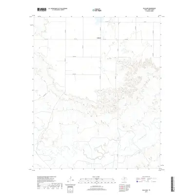
2019 Map of Gilliland
USGS Topo · Published 2019About this map
Gilliland sits at the junction of Fm 1756 E and Fm 267n in this modern survey of the North Texas plains. The settlement is defined by a sparse network of county roads, including Co RD 3691 and Co RD 3651, which segment the agricultural landscape into vast, geometric blocks. The southern portion of the quadrangle gives way to more complex topography as the terrain descends toward the winding path of the South Wichita River. This riparian corridor is fed by tributaries such as Ilseng Cr, cutting through the breaks that contrast with the level plains above. To the west, the presence of Put Ranch Rd suggests the historical ranching footprint that continues to shape land use and property boundaries in Knox County.
Find a feature on this map
16 named features on this map. Tap any name to fly to it.
Don’t see what you’re looking for? This feature index may not catch every label — zoom into the map to look around manually.
Map Details
Editions of this 2019 Gilliland Map
This is the sole edition of this map. No revisions or reprints were ever made.
Other maps of this area

1954 · Wichita Falls
USGS Topo · 1:250,000

1958 · Wichita Falls
USGS Topo · 1:250,000

1966 · Truscott North
USGS Topo · 1:24,000

1966 · Colwell Creek
USGS Topo · 1:24,000

1966 · Truscott South
USGS Topo · 1:24,000

1966 · Halsell Ranch
USGS Topo · 1:24,000

1966 · Gilliland
USGS Topo · 1:24,000

1966 · Vera
USGS Topo · 1:24,000

1967 · Hefner
USGS Topo · 1:24,000

1967 · Benjamin
USGS Topo · 1:24,000