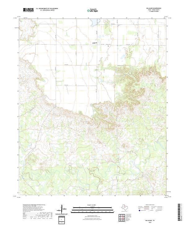
2022 Map of Gilliland
USGS Topo · Published 2022About this map
Gilliland serves as a central point in this rural Knox County landscape, where the flat upland agricultural fields to the north give way to the more complex drainage systems of the South Wichita River. The transition from the orderly grid of county roads, such as Co RD 3691 and Co RD 3590, into the winding paths of the Ilseng Cr watershed reveals the natural topography that has influenced land use in this part of West Texas for generations. Genealogy researchers will find the Gilliland Cem east of the main settlement, a quiet landmark situated near the junction of Fm 1756 E and several local routes. The southern portion of the area is defined by the braided channels and varied elevations surrounding the river, contrasting with the ranching and farming tracts accessed via Put Ranch RD.
Find a feature on this map
17 named features on this map. Tap any name to fly to it.
Don’t see what you’re looking for? This feature index may not catch every label — zoom into the map to look around manually.
Map Details
Editions of this 2022 Gilliland Map
This is the sole edition of this map. No revisions or reprints were ever made.
Other maps of this area

1954 · Wichita Falls
USGS Topo · 1:250,000

1958 · Wichita Falls
USGS Topo · 1:250,000

1966 · Truscott North
USGS Topo · 1:24,000

1966 · Colwell Creek
USGS Topo · 1:24,000

1966 · Truscott South
USGS Topo · 1:24,000

1966 · Halsell Ranch
USGS Topo · 1:24,000

1966 · Gilliland
USGS Topo · 1:24,000

1966 · Vera
USGS Topo · 1:24,000

1967 · Hefner
USGS Topo · 1:24,000

1967 · Benjamin
USGS Topo · 1:24,000