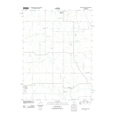
2012 Map of Gilman City East
USGS Topo · Published 2012About this map
The Bolton Post Office serves as a central landmark for the rural Missouri community of Bolton, where agricultural life is shaped by the winding tributaries of the Thompson River. The landscape is defined by a series of creeks, including Fox Creek, Cat Creek, and Sugar Creek, which carve through the countryside and support small impoundments like Theusen Lake Dam. To the south, the settlement of Melbourne and the eastern edge of Gilman City anchor the local geography. Family history is well-preserved across several burial grounds, from the Springer Chapel Cemetery near the northern border to the Mitchell Cemetery and Gilman Cemetery further south. Extensive preservation is evident in the Wayne Helton Memorial State Wildlife Area, which protects a significant portion of the northern terrain. This survey provides a clear view of the road network connecting these scattered hamlets via routes like Co HWY-666 and Co HWY-624.
Find a feature on this map
76 named features on this map. Tap any name to fly to it.
Don’t see what you’re looking for? This feature index may not catch every label — zoom into the map to look around manually.
Map Details
Editions of this 2012 Gilman City East Map
This is the sole edition of this map. No revisions or reprints were ever made.
Other maps of this area

1925 · Gilman
USGS Topo · 1:62,500

1946 · Gilman
USGS Topo · 1:48,000

1946 · Princeton
USGS Topo · 1:62,500

1947 · Blythedale
USGS Topo · 1:62,500

1948 · Gilman
USGS Topo · 1:62,500

1948 · Princeton
USGS Topo · 1:62,500

1948 · Trenton
USGS Topo · 1:62,500

1954 · Centerville
USGS Topo · 1:250,000

1957 · Centerville
USGS Topo · 1:250,000

1958 · Centerville
USGS Topo · 1:250,000