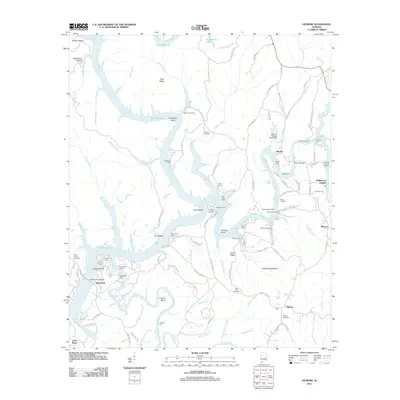
2011 Map of Gilmore
USGS Topo · Published 2011About this map
Bankhead Lake and its winding tributaries dominate this landscape, where the waters of the Locust Fork and Valley Creek converge. The shoreline is densely populated with seasonal and permanent river camps, reflecting a distinct culture of riverfront living at Driftwood, Riverwood Lodge, and Satterfield Camp. A complex network of river crossings and historical access points is evident, from the Franklin Ferry Bridge to the deep-water bends of Leeann Bend and Thompson Bend.
Find a feature on this map
122 named features on this map. Tap any name to fly to it.
Don’t see what you’re looking for? This feature index may not catch every label — zoom into the map to look around manually.
Map Details
Editions of this 2011 Gilmore Map
This is the sole edition of this map. No revisions or reprints were ever made.
Other maps of this area

1893 · Jasper
USGS Topo · 1:125,000

1899 · Brookwood
USGS Topo · 1:125,000

1927 · Adger
USGS Topo · 1:48,000

1929 · Searles
USGS Topo · 1:48,000

1932 · Yolande
USGS Topo · 1:62,500

1934 · Searles
USGS Topo · 1:62,500

1935 · Port Birmingham
USGS Topo · 1:48,000

1935 · Yolande
USGS Topo · 1:62,500

1938 · Port Birmingham
USGS Topo · 1:62,500

1949 · Parrish
USGS Topo · 1:24,000