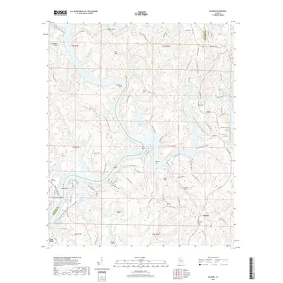
2018 Map of Gilmore
USGS Topo · Published 2018About this map
Bankhead Lake and the winding Locust Fork dominate this section of the Black Warrior River system along the border of Walker and Jefferson counties. The landscape is defined by the tight meanders of the river, creating prominent geographical features like Thompson Bend, Franklin Bend, and Leeann Bend. The settlement of Maxine sits near the Maxine Bridge, while the community of Gilmore is positioned to the south near several small cemeteries including Weaver Cem. Industrial history is evident in the presence of Tailings Pond Number 2, signaling the region's mining legacy. Numerous family-named landmarks and small creek branches, such as Glaze Creek and Sextons Br, provide specific detail for those tracing local history or genealogy. The map also records several shoals and hollows, including Heard Shoals and Drip Spring Hollow, which characterize the complex topography surrounding the river forks.
Find a feature on this map
121 named features on this map. Tap any name to fly to it.
Don’t see what you’re looking for? This feature index may not catch every label — zoom into the map to look around manually.
Map Details
Editions of this 2018 Gilmore Map
This is the sole edition of this map. No revisions or reprints were ever made.
Other maps of this area

1893 · Jasper
USGS Topo · 1:125,000

1899 · Brookwood
USGS Topo · 1:125,000

1927 · Adger
USGS Topo · 1:48,000

1929 · Searles
USGS Topo · 1:48,000

1932 · Yolande
USGS Topo · 1:62,500

1934 · Searles
USGS Topo · 1:62,500

1935 · Port Birmingham
USGS Topo · 1:48,000

1935 · Yolande
USGS Topo · 1:62,500

1938 · Port Birmingham
USGS Topo · 1:62,500

1949 · Parrish
USGS Topo · 1:24,000