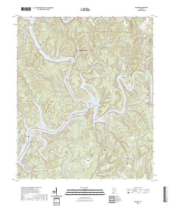
2024 Map of Gilmore
USGS Topo · Published 2024About this map
The confluence of the Mulberry Fork and Locust Fork defines this portion of the Black Warrior River valley along the border of Jefferson and Walker counties. This landscape is a record of river-based transport and heavy industrial activity, anchored by a series of crossings like McCarty's Ferry, Snow Ferry, and Taylor Ferry that historically linked these river-split communities. Industrial land use is evident at Maxine, where Tailings Pond Number 2 sits near the riverbanks, suggesting the region's deep ties to the coal and mining industries of the Alabama coalfields.
Find a feature on this map
129 named features on this map. Tap any name to fly to it.
Don’t see what you’re looking for? This feature index may not catch every label — zoom into the map to look around manually.
Map Details
Editions of this 2024 Gilmore Map
This is the sole edition of this map. No revisions or reprints were ever made.
Other maps of this area

1893 · Jasper
USGS Topo · 1:125,000

1899 · Brookwood
USGS Topo · 1:125,000

1927 · Adger
USGS Topo · 1:48,000

1929 · Searles
USGS Topo · 1:48,000

1932 · Yolande
USGS Topo · 1:62,500

1934 · Searles
USGS Topo · 1:62,500

1935 · Port Birmingham
USGS Topo · 1:48,000

1935 · Yolande
USGS Topo · 1:62,500

1938 · Port Birmingham
USGS Topo · 1:62,500

1949 · Parrish
USGS Topo · 1:24,000