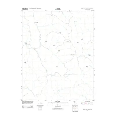
2012 Map of Gilroy Hot Springs
USGS Topo · Published 2012About this map
Gilroy Hot Springs and the surrounding Diablo Range backcountry are detailed in this 2012 survey. The landscape is defined by the drainage of Coyote Cr and the winding Cañada De Los Osos, punctuated by high points like Willson Peak and Vasquez Peak. This area, while largely undeveloped, contains significant local landmarks such as Hunting Hollow and the Willson Ranch, reflecting a long history of cattle ranching and recreational use of the mineral springs. Deep canyons like Dexter Canyon and Hagerman Canyon cut through the steep terrain, while named features like Bills Hill and Phegley Ridge provide orientation for those navigating this portion of Santa Clara County.
Find a feature on this map
24 named features on this map. Tap any name to fly to it.
Don’t see what you’re looking for? This feature index may not catch every label — zoom into the map to look around manually.
Map Details
Editions of this 2012 Gilroy Hot Springs Map
This is the sole edition of this map. No revisions or reprints were ever made.
Other maps of this area

1915 · San Juan Bautista
USGS Topo · 1:48,000

1917 · Morgan Hill
USGS Topo · 1:62,500

1917 · San Juan Bautista
USGS Topo · 1:62,500

1919 · Hollister
USGS Topo · 1:48,000

1921 · Gilroy Hot Springs
USGS Topo · 1:62,500

1921 · Hollister
USGS Topo · 1:62,500

1923 · Hollister
USGS Topo · 1:62,500

1939 · Morgan Hill
USGS Topo · 1:62,500

1939 · Gilroy Hot Springs
USGS Topo · 1:62,500

1939 · San Juan Bautista
USGS Topo · 1:62,500