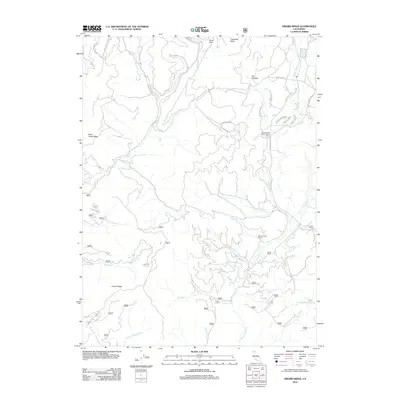
2012 Map of Girard Ridge
USGS Topo · Published 2012About this map
Girard Ridge and Soda Creek Ridge define the steep, creek-cut terrain of this Shasta County landscape. The network of Forest Service roads and ranching outposts like Willow Creek Ranch and the CooleyCircle Seven Ranch Resort shows how human activity has adapted to the high-elevation drainages of the southern Cascades. The map details a complex system of water sources, including Soda Springs, Water Trough Springs, and numerous named tributaries such as Squaw Valley Cr and Dairy Cr. Isolated landmarks like Dan Stevens and Ponto Park sit alongside more prominent natural features like Dogwood Butte, reflecting a region defined more by its natural topography and seasonal ranching than by dense permanent settlements. This 2012 survey provides a clear view of the modern infrastructure and geography of this upland wilderness area.
Find a feature on this map
48 named features on this map. Tap any name to fly to it.
Don’t see what you’re looking for? This feature index may not catch every label — zoom into the map to look around manually.
Map Details
Editions of this 2012 Girard Ridge Map
This is the sole edition of this map. No revisions or reprints were ever made.
Other maps of this area

1886 · Shasta
USGS Topo · 1:250,000

1894 · Shasta
USGS Topo · 1:250,000

1935 · Dunsmuir
USGS Topo · 1:125,000

1948 · Weed
USGS Topo · 1:250,000

1950 · Weed
USGS Topo · 1:250,000

1954 · Shoeinhorse Mountain
USGS Topo · 1:62,500

1954 · Shasta
USGS Topo · 1:62,500

1954 · Weed
USGS Topo · 1:62,500

1954 · Dunsmuir
USGS Topo · 1:62,500

1958 · Weed
USGS Topo · 1:250,000