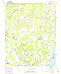
1966 Map of Girdletree
USGS Topo · Published 1974About this map
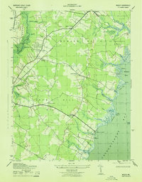
Pocomoke State Forest dominates the upper reaches of this coastal landscape, where the Pocomoke River winds past Milburn Landing. The map illustrates a dense network of family-named roads like Rayfield Road and Pilchard Road that connect small agrarian and maritime settlements along the Maryland-Virginia border. In the south, the terrain transitions into the salt marshes of Chincoteague Bay, revealing the distinct waterfront layout of Greenbackville and the nearby Franklin City. The presence of the Little Red Sch in Stockton and numerous country churches like Shiloh Ch and Gunby Ch highlights the importance of these village centers to the local community in the mid-1960s. Between these hubs, the landscape is defined by its water-powered history, evident in the Little Millpond and Big Millpond complexes.
Find a feature on this map
77 named features on this map. Tap any name to fly to it.
Don’t see what you’re looking for? This feature index may not catch every label — zoom into the map to look around manually.
Map Details
Editions of this 1966 Girdletree Map
4 editions found
Other maps of this area

1901 · Snow Hill
USGS Topo · 1:62,500

1942 · Chincoteague East
USGS Topo · 1:24,000

1942 · Snow Hill
USGS Topo · 1:24,000

1942 · Wesley
USGS Topo · 1:24,000

1942 · Dividing Creek
USGS Topo · 1:24,000

1943 · Snow Hill
USGS Topo · 1:31,680

1943 · Boxiron
USGS Topo · 1:31,680

1943 · Dividing Creek
USGS Topo · 1:31,680
1943 · Wesley
USGS Topo · 1:31,680

1943 · Chincoteague West
USGS Topo · 1:31,680