
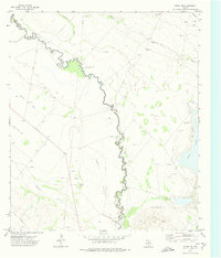
1972 Map of Girvin NE
USGS Topo · Published 1974About this map
Industrial energy infrastructure dominates this Permian Basin landscape along the boundary of Crane Co and Upton Co. Large-scale petroleum extraction is evident throughout the Roberdeau Oil Field and Crossett Oil Field, where a dense network of pipelines and facilities like a Pumping Sta and Substa crisscross the terrain. The topography is defined by the dramatic escarpment of King Mountain to the east, which overlooks the low-lying Spudder Flats. In the southwest corner, the ephemeral Soda Lake sits near the tracks of the At & Sf railroad. This 1970s survey captures the region as a critical energy corridor, marked by numerous Gravel Pits, an Oil Well, and prominent Radio Towers positioned on the high ground of the mountain plateau.
Find a feature on this map
18 named features on this map. Tap any name to fly to it.
Don’t see what you’re looking for? This feature index may not catch every label — zoom into the map to look around manually.
Map Details
Editions of this 1972 Girvin NE Map
This is the sole edition of this map. No revisions or reprints were ever made.
Other maps of this area

1928 · Crane
USGS Topo · 1:125,000

1954 · Pecos
USGS Topo · 1:250,000

1957 · Pecos
USGS Topo · 1:250,000

1971 · Marlboro Canyon
USGS Topo · 1:24,000
1972 · McCamey South
USGS Topo · 1:24,000
1972 · McCamey North
USGS Topo · 1:24,000
1972 · Girvin
USGS Topo · 1:24,000
1972 · Girvin SE
USGS Topo · 1:24,000
1972 · Girvin NW
USGS Topo · 1:24,000

1974 · Crane SW
USGS Topo · 1:24,000