
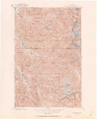
1899 Map of Glacier Peak
USGS Topo · Published 1955About this map
Glacier Peak dominates the high alpine landscape of this late 19th-century survey, surrounded by a complex system of ice fields including Suiattle Glacier, Honeycomb Gl, and White River Glacier. The map captures the early footprint of human presence in the Cascades, where small outposts like Mineral Park, Gilbert, and Bedal sit at the confluence of glacial rivers. These settlements, often tied to prospecting and early forestry, are linked by trails through high-altitude corridors like White Pass and Totem Pass.
Find a feature on this map
115 named features on this map. Tap any name to fly to it.
Don’t see what you’re looking for? This feature index may not catch every label — zoom into the map to look around manually.
Map Details
Editions of this 1899 Glacier Peak Map
2 editions found
Other maps of this area

1899 · Stillaguamish
USGS Topo · 1:125,000

1901 · Glacier Peak
USGS Topo · 1:125,000

1901 · Stilaguamish
USGS Topo · 1:125,000

1901 · Chiwaukum
USGS Topo · 1:125,000

1902 · Skykomish
USGS Topo · 1:125,000

1902 · Stehekin
USGS Topo · 1:125,000

1904 · Stehekin
USGS Topo · 1:125,000

1904 · Chiwaukum
USGS Topo · 1:125,000

1905 · Skykomish
USGS Topo · 1:125,000

1909 · Mt Baker
USGS Topo · 1:192,000