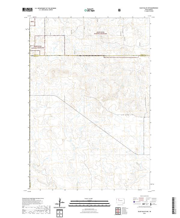
2021 Map of Glad Valley NW
USGS Topo · Published 2021About this map
The Grand River National Grassland dominates the northern reaches of this landscape along the border of Corson and Ziebach counties. The terrain is defined by a dendritic network of drainages, where seasonal watercourses like Beef Creek and Twin Butte Creek carve through the high plains. The absence of concentrated town sites reflects the region's character as a managed open range, where land use is dictated by the Public Land Survey System grids of t17n r17e and t17n r18e. Geologists and land managers can trace the winding paths of Tourney Creek and Blue Creek as they navigate the subtle elevation changes of this prairie environment, providing a detailed record of the natural hydrology and early 21st-century boundary delineations in this portion of South Dakota.
Find a feature on this map
12 named features on this map. Tap any name to fly to it.
Don’t see what you’re looking for? This feature index may not catch every label — zoom into the map to look around manually.
Map Details
Editions of this 2021 Glad Valley NW Map
This is the sole edition of this map. No revisions or reprints were ever made.
Other maps of this area

1953 · McIntosh
USGS Topo · 1:250,000

1954 · Lemmon
USGS Topo · 1:250,000

1957 · Lemmon
USGS Topo · 1:250,000

1958 · McIntosh
USGS Topo · 1:250,000

1972 · Black Horse Butte
USGS Topo · 1:24,000

1972 · Twin Butte
USGS Topo · 1:24,000

1980 · McIntosh
USGS Topo · 1:100,000

1982 · Glad Valley
USGS Topo · 1:24,000

1982 · Glad Valley SW
USGS Topo · 1:24,000

1982 · Glad Valley NW
USGS Topo · 1:24,000