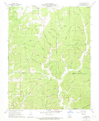
1967 Map of Gladden
USGS Topo · Published 1969About this map
Clark National Forest lands dominate this mid-century portrait of the Ozark hills along the border of Dent and Shannon counties. The terrain is defined by a dense network of winding hollows and springs, including Still Spring and the notable Whaley Cave Spring. Small rural communities such as Gladden, Rector, and Shannondale serve as focal points for local history, surrounded by a landscape carved by Barren Fork and Sinking Creek. The presence of numerous family and community burial grounds, such as Empire Cem, Bedwell Cem, and Pilgrims Rest Cem, offers significant value for genealogists tracing regional lineages. Unique geological and landmark features like Devils Well and Standing Rock further distinguish this section of the Missouri countryside during a period of established forest management and rural settlement.
Find a feature on this map
56 named features on this map. Tap any name to fly to it.
Don’t see what you’re looking for? This feature index may not catch every label — zoom into the map to look around manually.
Map Details
Editions of this 1967 Gladden Map
This is the sole edition of this map. No revisions or reprints were ever made.
Other maps of this area

1932 · Cedar Grove
USGS Topo · 1:48,000

1941 · Salem
USGS Topo · 1:62,500

1941 · Stone Hill
USGS Topo · 1:62,500

1945 · Salem
USGS Topo · 1:62,500

1945 · Stone Hill
USGS Topo · 1:62,500

1945 · Round Spring
USGS Topo · 1:62,500

1947 · Sinkin
USGS Topo · 1:48,000

1949 · Round Spring
USGS Topo · 1:62,500

1949 · Rolla
USGS Topo · 1:250,000

1951 · Cedargrove
USGS Topo · 1:24,000