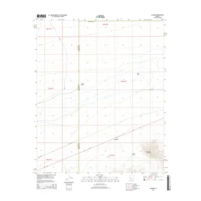
2014 Map of Gladden
USGS Topo · Published 2014About this map
The settlement of Gladden occupies a central position along the Us-60 corridor, situated where the arid plains of McMullen Valley meet the rising foothills of the Harquahala Mountains. This 2014 survey documents a landscape defined by its ranching infrastructure and vast drainage systems. Water management is critical in this high-desert environment, evidenced by livestock watering points like Sunset Tank and Dushey Tank.
Find a feature on this map
19 named features on this map. Tap any name to fly to it.
Don’t see what you’re looking for? This feature index may not catch every label — zoom into the map to look around manually.
Map Details
Editions of this 2014 Gladden Map
This is the sole edition of this map. No revisions or reprints were ever made.
Other maps of this area
1923 · Signal
USGS Topo · 1:250,000
1942 · Signal
USGS Topo · 1:250,000
1942 · Vicksburg
USGS Topo · 1:250,000
1950 · Prescott
USGS Topo · 1:250,000
1954 · Prescott
USGS Topo · 1:250,000
1954 · Phoenix
USGS Topo · 1:250,000
1957 · Phoenix
USGS Topo · 1:250,000
1958 · Prescott
USGS Topo · 1:250,000
1958 · Phoenix
USGS Topo · 1:250,000
1959 · Prescott
USGS Topo · 1:250,000