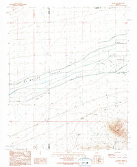
1989 Map of Gladden
USGS Topo · Published 1990About this map
Gladden sits at the junction of desert basins and high relief late in the twentieth century, marking a point where the Aguila Valley and Mc Mullen Valley converge. The landscape is defined by extensive irrigation and water management infrastructure, evidenced by numerous instances of Abandoned Ditch and prominent Spoil Bank earthworks running through the valley floors. These features, alongside a Landing Strip and a significant Substation, indicate a history of large-scale agricultural attempts and utility development in this arid Maricopa County corridor.
Find a feature on this map
20 named features on this map. Tap any name to fly to it.
Don’t see what you’re looking for? This feature index may not catch every label — zoom into the map to look around manually.
Map Details
Editions of this 1989 Gladden Map
This is the sole edition of this map. No revisions or reprints were ever made.
Other maps of this area

1923 · Signal
USGS Topo · 1:250,000

1942 · Signal
USGS Topo · 1:250,000

1942 · Vicksburg
USGS Topo · 1:250,000

1950 · Prescott
USGS Topo · 1:250,000

1954 · Prescott
USGS Topo · 1:250,000

1954 · Phoenix
USGS Topo · 1:250,000

1957 · Phoenix
USGS Topo · 1:250,000

1958 · Prescott
USGS Topo · 1:250,000

1958 · Phoenix
USGS Topo · 1:250,000

1959 · Prescott
USGS Topo · 1:250,000