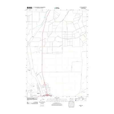
2011 Map of Glade
USGS Topo · Published 2011About this map
The northern reaches of Pasco meet the rural agricultural landscape of Franklin County in this 2011 survey. The layout is dominated by the commercial and transport infrastructure supporting the Tri-Cities region, most notably the Tri-Cities Airport and the complex interchange where Highway 395 and Interstate 182 converge. Modern industrial development is evident along N Industrial Way and N Railroad Ave, while the surrounding terrain remains defined by the winding depression of the Esquatzel Coulee. To the north, the small settlement of Glade sits amidst an orderly grid of country roads including Phend RD and Smith Rd, illustrating the region's transition from high-density aviation and transit hubs to expansive irrigation-fed farmland.
Find a feature on this map
50 named features on this map. Tap any name to fly to it.
Don’t see what you’re looking for? This feature index may not catch every label — zoom into the map to look around manually.
Map Details
Editions of this 2011 Glade Map
This is the sole edition of this map. No revisions or reprints were ever made.
Other maps of this area

1915 · Wallulah
USGS Topo · 1:96,000

1917 · Pasco
USGS Topo · 1:125,000

1918 · Wallula
USGS Topo · 1:125,000

1953 · Walla Walla
USGS Topo · 1:250,000

1958 · Walla Walla
USGS Topo · 1:250,000

1963 · Rye Grass Coulee
USGS Topo · 1:24,000

1964 · Levey SW
USGS Topo · 1:24,000

1964 · Humorist
USGS Topo · 1:24,000

1964 · Kennewick
USGS Topo · 1:24,000

1964 · Pasco
USGS Topo · 1:62,500