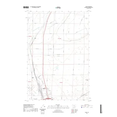
2020 Map of Glade
USGS Topo · Published 2020About this map
Pasco serves as the focal point of this map, situated in the arid landscape of Franklin County just as the city’s industrial and transportation infrastructure continues to expand northward. The Tri-Cities Airport occupies a significant portion of the southwestern corner, flanked by the residential and agricultural transition seen at Glade. The map captures the complex water management systems of the region, specifically the Esquatzel Diversion Channel and Esquatzel Coulee, which are critical for irrigation and drainage in this dry climate. A grid of rural roads such as Selph Landing Rd and Locust Grove Rd highlights the organized agricultural parcels that define the land north of the city center. This survey provides a clear look at the intersection of municipal expansion and the geographic constraints of Lower Smith Canyon, illustrating how the desert terrain has been reshaped by human engineering.
Find a feature on this map
58 named features on this map. Tap any name to fly to it.
Don’t see what you’re looking for? This feature index may not catch every label — zoom into the map to look around manually.
Map Details
Editions of this 2020 Glade Map
This is the sole edition of this map. No revisions or reprints were ever made.
Other maps of this area

1915 · Wallulah
USGS Topo · 1:96,000

1917 · Pasco
USGS Topo · 1:125,000

1918 · Wallula
USGS Topo · 1:125,000

1953 · Walla Walla
USGS Topo · 1:250,000

1958 · Walla Walla
USGS Topo · 1:250,000

1963 · Rye Grass Coulee
USGS Topo · 1:24,000

1964 · Levey SW
USGS Topo · 1:24,000

1964 · Humorist
USGS Topo · 1:24,000

1964 · Kennewick
USGS Topo · 1:24,000

1964 · Pasco
USGS Topo · 1:62,500