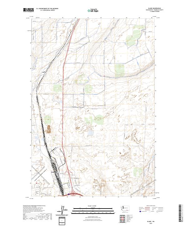
2023 Map of Glade
USGS Topo · Published 2023About this map
The agricultural and industrial interface of northern Pasco is defined by complex water management and transportation corridors in this recent survey. The landscape is dominated by the Esquatzel Coulee and the man-made Esquatzel Diversion Channel, which manage drainage across this section of the Columbia Basin. The small settlement of Glade sits along the Selph Landing Rd, serving as a focal point for the surrounding rural road network that includes family-named routes like Blasdel Rd and Piekarski Rd.
Find a feature on this map
58 named features on this map. Tap any name to fly to it.
Don’t see what you’re looking for? This feature index may not catch every label — zoom into the map to look around manually.
Map Details
Editions of this 2023 Glade Map
This is the sole edition of this map. No revisions or reprints were ever made.
Other maps of this area

1915 · Wallulah
USGS Topo · 1:96,000

1917 · Pasco
USGS Topo · 1:125,000

1918 · Wallula
USGS Topo · 1:125,000

1953 · Walla Walla
USGS Topo · 1:250,000

1958 · Walla Walla
USGS Topo · 1:250,000

1963 · Rye Grass Coulee
USGS Topo · 1:24,000

1964 · Levey SW
USGS Topo · 1:24,000

1964 · Humorist
USGS Topo · 1:24,000

1964 · Kennewick
USGS Topo · 1:24,000

1964 · Pasco
USGS Topo · 1:62,500