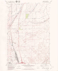
1979 Map of Glade
USGS Topo · Published 1979About this map
The Esquatzel Coulee defines the landscape of Franklin County in the late 1970s, illustrating the complex intersection of natural geology and large-scale irrigation engineering. This survey reveals a meticulously managed desert environment where the Eltopia Branch Canal, Northern Diversion Channel, and various Siphons facilitate agriculture across the arid plateau. The transportation and industrial backbone of the region is anchored by the Burlington Northern railroad corridor, which runs parallel to the coulee toward the southern hub.
Find a feature on this map
28 named features on this map. Tap any name to fly to it.
Don’t see what you’re looking for? This feature index may not catch every label — zoom into the map to look around manually.
Map Details
Editions of this 1979 Glade Map
This is the sole edition of this map. No revisions or reprints were ever made.
Other maps of this area

1915 · Wallulah
USGS Topo · 1:96,000

1917 · Pasco
USGS Topo · 1:125,000

1918 · Wallula
USGS Topo · 1:125,000

1953 · Walla Walla
USGS Topo · 1:250,000

1958 · Walla Walla
USGS Topo · 1:250,000

1963 · Rye Grass Coulee
USGS Topo · 1:24,000

1964 · Levey SW
USGS Topo · 1:24,000

1964 · Humorist
USGS Topo · 1:24,000

1964 · Kennewick
USGS Topo · 1:24,000

1964 · Pasco
USGS Topo · 1:62,500