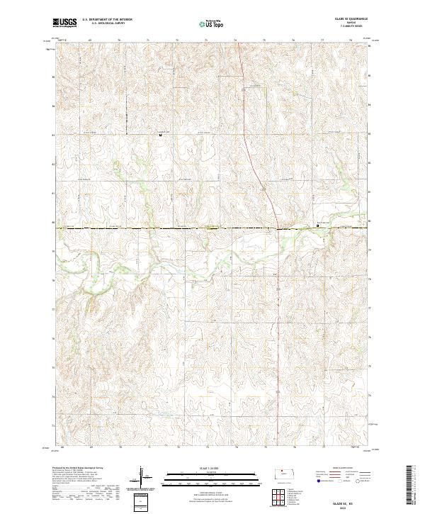
2022 Map of Glade SE
USGS Topo · Published 2022About this map
Bow Creek meanders across the central landscape of this Phillips County terrain, carving a distinct valley through the agricultural sections of Rooks and Phillips counties. The 2022 survey illustrates the rectilinear grid of local roads and township boundaries that define the region, following the Public Land Survey System. This drainage pattern of Bow Creek and its unnamed tributaries suggests the gradual erosion of the high plains, where deep-cut draws and rounded divides create the characteristic topography of north-central Kansas.
Find a feature on this map
1 named feature on this map. Tap any name to fly to it.
Don’t see what you’re looking for? This feature index may not catch every label — zoom into the map to look around manually.
Map Details
Editions of this 2022 Glade SE Map
This is the sole edition of this map. No revisions or reprints were ever made.
Other maps of this area

1893 · Phillipsburg
USGS Topo · 1:125,000

1896 · Plainville
USGS Topo · 1:125,000

1952 · Webster Dam
USGS Topo · 1:24,000

1953 · Woodston NW
USGS Topo · 1:24,000

1953 · Stockton
USGS Topo · 1:24,000

1955 · Beloit
USGS Topo · 1:250,000

1959 · Beloit
USGS Topo · 1:250,000

1961 · Kirwin SW
USGS Topo · 1:24,000

1972 · Speed
USGS Topo · 1:24,000

1972 · Glade SW
USGS Topo · 1:24,000