
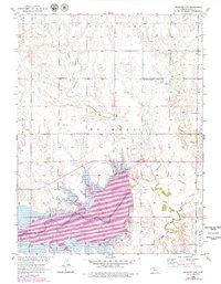
1952 Map of Webster Dam
USGS Topo · Published 1955About this map
The South Fork Solomon River valley in Rooks County undergoes a dramatic transformation on this 1952 survey as the Webster Dam (Under Construction) begins to reshape the landscape. Broken light-blue lines clearly delineate the future reservoir boundary, showing the area destined for submergence, which includes portions of the original townsite of Webster. This map serves as a vital record for genealogists, documenting the location of Webster Cem and Mt Vernon Cem before the water levels were altered.
Find a feature on this map
24 named features on this map. Tap any name to fly to it.
Don’t see what you’re looking for? This feature index may not catch every label — zoom into the map to look around manually.
Map Details
Editions of this 1952 Webster Dam Map
2 editions found
Other maps of this area

1893 · Norton
USGS Topo · 1:125,000

1893 · Phillipsburg
USGS Topo · 1:125,000

1893 · Hill
USGS Topo · 1:125,000

1896 · Plainville
USGS Topo · 1:125,000

1953 · Stockton
USGS Topo · 1:24,000

1955 · Beloit
USGS Topo · 1:250,000

1959 · Beloit
USGS Topo · 1:250,000

1969 · Nicodemus
USGS Topo · 1:24,000

1969 · Palco
USGS Topo · 1:24,000

1969 · Stockton SW
USGS Topo · 1:24,000