
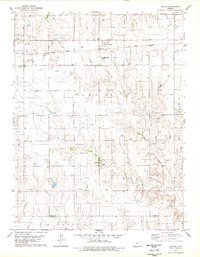
1969 Map of Stockton SW
USGS Topo · Published 1971About this map
Webster Reservoir occupies the northern edge of this Rooks County landscape, where the waters of the Webster basin meet the undulating terrain of Rush and Logan. The map reveals a mid-century rural economy defined by resource extraction and agriculture, evidenced by numerous Oil Wells, Shale Pits, and the Hayden Oil Field scattered across the township boundaries. These industrial sites are interspersed with symbols of early settlement life, such as the Eureka Cem, which sits near the center of the survey area. The drainage of Lost Creek and the Jelinek oil field area illustrate the complex relationship between the natural topography and the development of local energy resources during this period of the Missouri River Basin development program.
Find a feature on this map
21 named features on this map. Tap any name to fly to it.
Don’t see what you’re looking for? This feature index may not catch every label — zoom into the map to look around manually.
Map Details
Editions of this 1969 Stockton SW Map
This is the sole edition of this map. No revisions or reprints were ever made.
Other maps of this area

1893 · Hill
USGS Topo · 1:125,000

1896 · Plainville
USGS Topo · 1:125,000

1952 · Webster Dam
USGS Topo · 1:24,000

1953 · Stockton
USGS Topo · 1:24,000

1955 · Beloit
USGS Topo · 1:250,000

1959 · Beloit
USGS Topo · 1:250,000

1969 · Nicodemus
USGS Topo · 1:24,000

1969 · Palco
USGS Topo · 1:24,000

1978 · Plainville
USGS Topo · 1:24,000
1978 · Zurich
USGS Topo · 1:24,000