1978 Map of Zurich
USGS Topo · Published 1979About this map
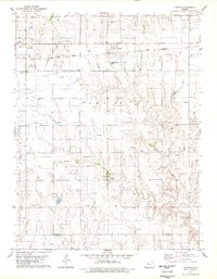
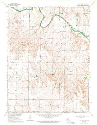
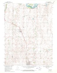
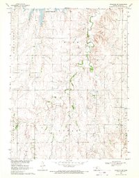
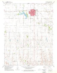
Zurich serves as the primary rail settlement in this late 1970s survey, positioned along the Union Pacific line where it cuts through the northern Rooks County landscape. The town site is characterized by its organized grid and proximity to communal infrastructure like the local Cem and Sewage Disposal Ponds. The surrounding territory is defined by a dense concentration of petroleum extraction, with numerous Oil Wells and a significant Oil Field occupying the plains. Drainage for the region is provided by the winding path of Sand Creek, which flows through the eastern portion of the quadrangle. In the southwest, a Radio Tower stands as a prominent local landmark near the boundary line between Rooks County and Ellis County.
Find a feature on this map
18 named features on this map. Tap any name to fly to it.
Don’t see what you’re looking for? This feature index may not catch every label — zoom into the map to look around manually.
Map Details
Editions of this 1978 Zurich Map
This is the sole edition of this map. No revisions or reprints were ever made.
Other maps of this area

1893 · Hill
USGS Topo · 1:125,000

1896 · Plainville
USGS Topo · 1:125,000

1955 · Beloit
USGS Topo · 1:250,000

1959 · Beloit
USGS Topo · 1:250,000
1963 · Hill City 4 SE
USGS Topo · 1:24,000
1969 · Palco
USGS Topo · 1:24,000
1969 · Stockton SW
USGS Topo · 1:24,000
1978 · Plainville
USGS Topo · 1:24,000

1978 · Plainville SW
USGS Topo · 1:24,000

1978 · Plainville SE
USGS Topo · 1:24,000