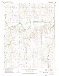
1978 Map of Plainville SW
USGS Topo · Published 1979About this map
The Saline River carves a winding path across this portion of northern Ellis County, defining a landscape where ranching and resource extraction meet. Surveyed in the late 1970s, the terrain transitions from the river valley to the elevated Buckeye region, characterized by numerous Oil Wells and a dedicated Oil Field that speak to the area's mid-century energy development. Local history is anchored by the St Andrew Ch and the nearby Cem, while further south, the Hyacinth Cem serves as a quiet marker of early settlement. Named landmarks like Kroeger and drainages such as East Spring Creek offer specific touchpoints for genealogists and researchers tracking family landholdings and the rural infrastructure of the High Plains during this era.
Find a feature on this map
12 named features on this map. Tap any name to fly to it.
Don’t see what you’re looking for? This feature index may not catch every label — zoom into the map to look around manually.
Map Details
Editions of this 1978 Plainville SW Map
This is the sole edition of this map. No revisions or reprints were ever made.
Other maps of this area

1893 · Ellis
USGS Topo · 1:125,000

1893 · Hill
USGS Topo · 1:125,000

1896 · Hays
USGS Topo · 1:125,000

1896 · Plainville
USGS Topo · 1:125,000

1955 · Great Bend
USGS Topo · 1:250,000

1955 · Beloit
USGS Topo · 1:250,000

1957 · Great Bend
USGS Topo · 1:250,000

1958 · Great Bend
USGS Topo · 1:250,000

1959 · Beloit
USGS Topo · 1:250,000

1961 · Yocemento
USGS Topo · 1:24,000