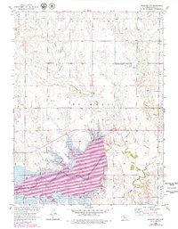
1952 Map of Webster Dam
USGS Topo · Published 1979About this map
The South Fork Solomon River dominates this Rooks County landscape, defined here by the creation of the Webster Reservoir and the establishment of Webster State Park. This mid-century survey, updated in the late 1970s, captures the transition of the valley from agricultural river bottom to a managed recreational and water-storage basin. The small settlement of Webster is situated just south of the dam, supported by local infrastructure including a landing strip and the nearby Webster Cemetery.
Find a feature on this map
22 named features on this map. Tap any name to fly to it.
Don’t see what you’re looking for? This feature index may not catch every label — zoom into the map to look around manually.
Map Details
Editions of this 1952 Webster Dam Map
2 editions found
Other maps of this area

1893 · Norton
USGS Topo · 1:125,000

1893 · Phillipsburg
USGS Topo · 1:125,000

1893 · Hill
USGS Topo · 1:125,000

1896 · Plainville
USGS Topo · 1:125,000

1952 · Webster Dam
USGS Topo · 1:24,000

1953 · Stockton
USGS Topo · 1:24,000

1955 · Beloit
USGS Topo · 1:250,000

1959 · Beloit
USGS Topo · 1:250,000

1969 · Nicodemus
USGS Topo · 1:24,000

1969 · Palco
USGS Topo · 1:24,000