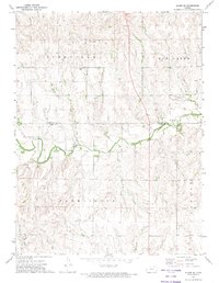
1972 Map of Glade SE
USGS Topo · Published 1974About this map
Bow Creek meanders through the central portion of this 1970s landscape, marking the natural boundary between Phillips Co and Rooks Co. The map captures the rural agricultural structure of North Central Kansas, organized by the historical townships of Rushville, Farmington, and Lanark. Local civic life is anchored by a centrally located Townhall near the creek's edge, while the presence of Gravel Pits and an Oil Well suggest the modest industrial extraction occurring alongside traditional farming. Family researchers will find the locations of Lockwood Cem and Bow Creek Cem particularly valuable for grounding local genealogy. The transition from upland plains to the creek valley is detailed through fine contour intervals, showing the drainage patterns of Bortin Creek and the installation of a Gaging Station used for monitoring the watershed.
Find a feature on this map
15 named features on this map. Tap any name to fly to it.
Don’t see what you’re looking for? This feature index may not catch every label — zoom into the map to look around manually.
Map Details
Editions of this 1972 Glade SE Map
This is the sole edition of this map. No revisions or reprints were ever made.
Other maps of this area

1893 · Phillipsburg
USGS Topo · 1:125,000

1896 · Plainville
USGS Topo · 1:125,000

1952 · Webster Dam
USGS Topo · 1:24,000

1953 · Woodston NW
USGS Topo · 1:24,000

1953 · Stockton
USGS Topo · 1:24,000

1955 · Beloit
USGS Topo · 1:250,000

1959 · Beloit
USGS Topo · 1:250,000

1961 · Kirwin SW
USGS Topo · 1:24,000

1972 · Speed
USGS Topo · 1:24,000

1972 · Glade SW
USGS Topo · 1:24,000