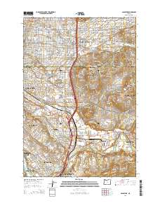
2014 Map of Gladstone
USGS Topo · Published 2014About this map
Portland's southeastern reach and its surrounding Clackamas County suburbs are shown here in detail, centered on the residential and commercial corridors of Lents and Woodstock. This landscape is defined by its transition from urban neighborhoods like Arleta and Eastmoreland into the hilly terrain of Mt Scott and Mt Talbert. A significant portion of the area's geography is dedicated to memorial sites, including the expansive Willamette National Cem and Lincoln Memorial Cemetery.
Find a feature on this map
74 named features on this map. Tap any name to fly to it.
Don’t see what you’re looking for? This feature index may not catch every label — zoom into the map to look around manually.
Map Details
Editions of this 2014 Gladstone Map
This is the sole edition of this map. No revisions or reprints were ever made.
Other maps of this area

1897 · Portland
USGS Topo · 1:62,500

1905 · Portland
USGS Topo · 1:62,500

1911 · Boring
USGS Topo · 1:48,000

1914 · Boring
USGS Topo · 1:62,500

1914 · Oregon City
USGS Topo · 1:62,500

1916 · Estacada
USGS Topo · 1:125,000

1918 · Troutdale
USGS Topo · 1:62,500

1934 · Troutdale
USGS Topo · 1:48,000

1939 · Oregon City
USGS Topo · 1:62,500

1940 · Boring
USGS Topo · 1:62,500