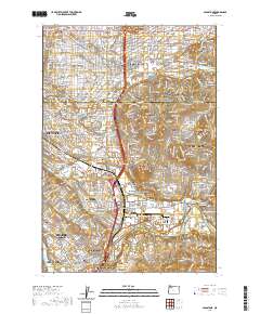
2020 Map of Gladstone
USGS Topo · Published 2020About this map
The Clackamas River defines the southern reach of this landscape, winding past Beebe Island and through the established communities of Gladstone, West Linn, and Oregon City. This 2020 edition reveals the dense residential and institutional development on the suburban edge of Portland, where modern campuses like Clackamas Community College Harmony Campus and the Birthingway College of Midwifery sit among historic burial grounds such as Lincoln Memorial Cem and Sunnyside Cem.
Find a feature on this map
61 named features on this map. Tap any name to fly to it.
Don’t see what you’re looking for? This feature index may not catch every label — zoom into the map to look around manually.
Map Details
Editions of this 2020 Gladstone Map
This is the sole edition of this map. No revisions or reprints were ever made.
Other maps of this area

1897 · Portland
USGS Topo · 1:62,500

1905 · Portland
USGS Topo · 1:62,500

1911 · Boring
USGS Topo · 1:48,000

1914 · Boring
USGS Topo · 1:62,500

1914 · Oregon City
USGS Topo · 1:62,500

1916 · Estacada
USGS Topo · 1:125,000

1918 · Troutdale
USGS Topo · 1:62,500

1934 · Troutdale
USGS Topo · 1:48,000

1939 · Oregon City
USGS Topo · 1:62,500

1940 · Boring
USGS Topo · 1:62,500