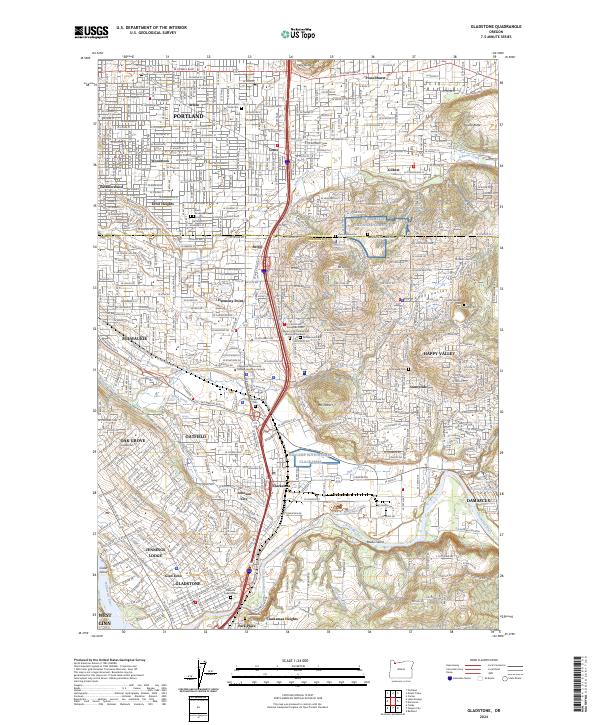
2024 Map of Gladstone
USGS Topo · Published 2024About this map
The Clackamas River and Willamette River anchor the southern reaches of this landscape, where the communities of Gladstone, Jennings Lodge, and West Linn converge near the water. Further north, the terrain transitions into the dense residential grids of Portland, including neighborhoods like Eastmoreland, Lents, and Woodstock. The geography is defined by several prominent rises, such as Mt Scott, Mt Talbert, and Kelly Butte, which separate the suburban developments of Happy Valley from the industrial and transit corridors flanking the Milwaukie Expy.
Find a feature on this map
59 named features on this map. Tap any name to fly to it.
Don’t see what you’re looking for? This feature index may not catch every label — zoom into the map to look around manually.
Map Details
Editions of this 2024 Gladstone Map
This is the sole edition of this map. No revisions or reprints were ever made.
Other maps of this area

1897 · Portland
USGS Topo · 1:62,500

1905 · Portland
USGS Topo · 1:62,500

1911 · Boring
USGS Topo · 1:48,000

1914 · Boring
USGS Topo · 1:62,500

1914 · Oregon City
USGS Topo · 1:62,500

1916 · Estacada
USGS Topo · 1:125,000

1918 · Troutdale
USGS Topo · 1:62,500

1934 · Troutdale
USGS Topo · 1:48,000

1939 · Oregon City
USGS Topo · 1:62,500

1940 · Boring
USGS Topo · 1:62,500